Bike to Happy Hour (B2HH) – Hopping Gnome
Below we’ve put together some routes from randomly chosen locations from different parts of Wichita. We used Garmin Connect’s Course Planning function to lay out some general routes. Then we modified those routes to prioritize low-stress, low-risk routes. Our aim was to give some general directional routes that could be tapped and personalized for your particular location. We recommend using tips on the Route Planning page to help identify a route that works best for you, your skill and comfort level.
These routes are publicly available on Garmin Connect if you have a Garmin device you want to send them to. Go to Courses –> Nearby Courses –> Filters. Then filter course name by “B2HH” to see the full list of offerings.

Southwest Wichita to Hopping Gnome
Starting at Glenn Park Christian Church
- Head East on W 27th St S toward S Osage Ave.
- Turn left and head North on S Osage Ave toward W Pawnee St.
- Turn right and head East on W Pawnee St to the intersection with McLean Blvd.
- At the intersection, turn left, enter the Riverside Trail and head North towards W 1st St N.
- Head East on W 1st St N towards N Hydraulic Ave.
- Turn right and head South on N Hydraulic Ave toward E Douglas Ave.
- Hopping Gnome will be to your left.
Distance: 6.04 miles
Overall Ascent/Descent: 10 ft

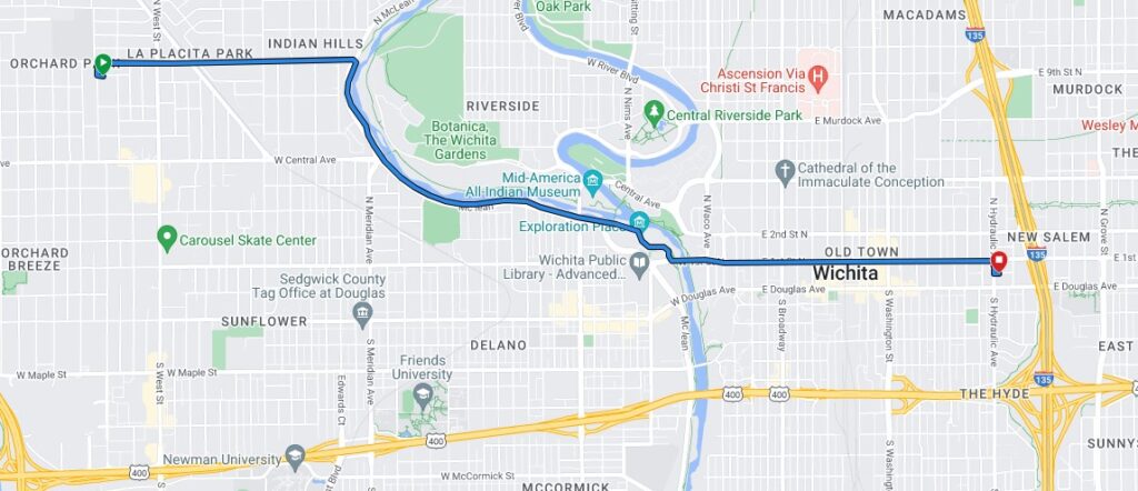
West Wichita to Hopping Gnome
Starting at Hadley Middle School –
- Head East on W 9th St N towards N McLean Blvd.
- Cross McLean and enter the Riverside Trail.
- Head South on the Riverside Trail to W 1st St N.
- Head East on W 1st St N towards N Hydraulic Ave. Turn right and head South on Hydraulic towards Douglas Ave.
- Hopping Gnome will be to your left.
Distance: 5.01 miles
Overall Ascent/Descent: -17 ft

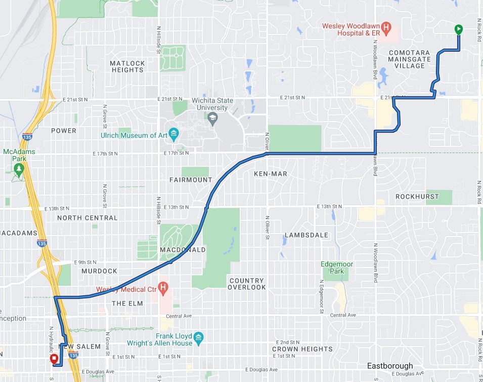
Northeast Wichita to Hopping Gnome
Starting at Calvary United Methodist Church
- Head West on E 26th St N towards N Longfellow St.
- Turn left and head South on N Longfellow St. toward E 24th St N.
- Turn right and head West on E 24th St N following the curve South onto N Rutland Rd.
- Turn right head Southwest on Bainbridge Rd. following the road as it curves and terminates on N Bramblewood St.
- Turn left and head Southwest on N Bramblewood St toward E 21st St N.
- Cross E 21st St N and continue riding South along N Bramblewood St towards N Woodlawn Blvd.
- Turn left and head South on N Woodland Blvd towards the Red Bud Trail.
- Turn right and head West on the Red Bud Trail toward I-135.
- Turn left and head South along the Canal Hike & Bike Trial underneath I-135 towards 2nd Street.
- Cross E 2nd St and turn right onto E 2nd St’s sidewalk. Head West on E 2nd St toward downtown.
- Take the first left onto N Kansas Ave. Follow N Kansas Ave South towards Victor St.
- Turn right onto Victor St and head West. Hopping Gnome will be to your left.
Distance: 6.25 miles
Overall Ascent/Descent: -111 ft

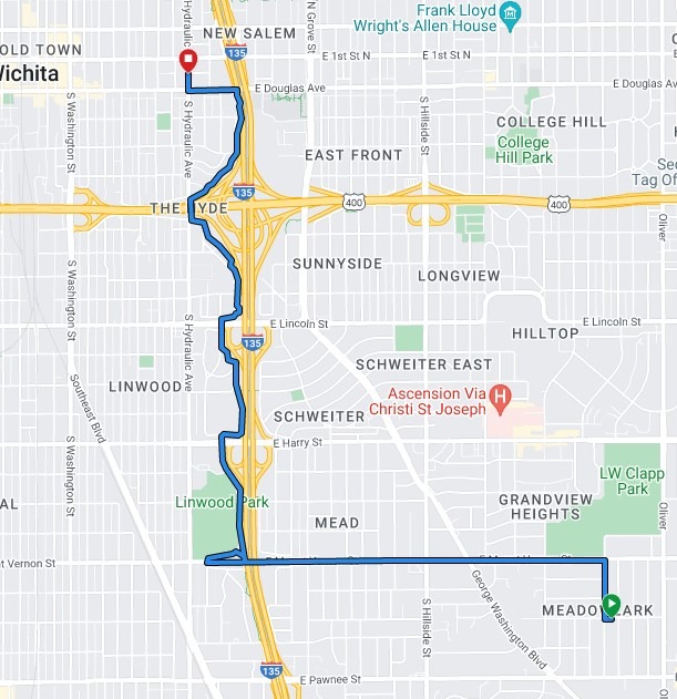
Southeast Wichita to Hopping Gnome
Starting at WSU Tech
- Head South on S Roosevelt St towards Countryside St.
- Turn right and head West on Countryside St toward George Washington Blvd.
- Cross George Washington Blvd and proceed South towards E Funston St.
- Turn right and head West on E Funston towards I-135.
- As E Funston St approaches I-135, it will curve South. Use the pedestrian bridge near the curve to continue West over I-135.
- Exit the pedestrian bridge, turn right and head North along S Kansas Ave and continue under the E Harry St. bridge.
- Once past the E Harry St Bridge, enter the Canal Hike & Bike Trail by turning right heading East.
- Follow the Canal Hike & Bike Trail North along I-135 past Kellogg toward E Douglas Ave.
- Turn left and exit the Canal Hike & Bike Trail onto E Douglas Ave sidewalk.
- Head West on E Douglas Ave towards downtown.
- Turn right on N Kansas Ave and head North towards Victor St.
- Turn left on Victor St and head West. Hopping Gnome will be to your left.
Distance: 4.00 miles
Overall Ascent/Descent: -44 ft